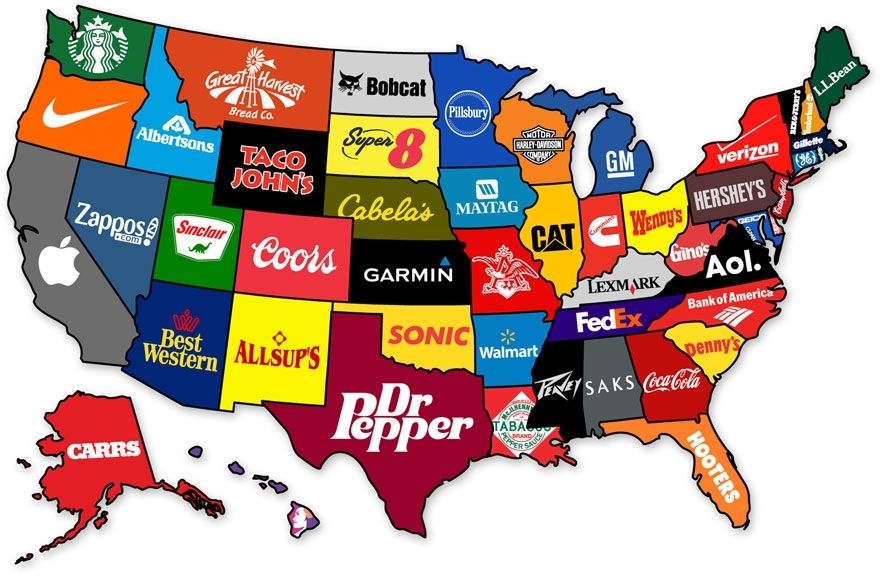
By the time we graduate high school, we learn that they never taught us the most interesting things in there. Sure, you might be able to name the European countries or point New York on the map, but does that give a you real understanding of how the world functions? To fill this gap, we have gathered a great and informative selection of infographical maps that they should’ve shown us at school: every single one of these maps reveals different fun and interesting facts, which can actually help you draw some pretty interesting conclusions. What makes infographical maps so engaging is how easy it becomes to conceive graphically presented information. The best part, there are brilliant services like Target Map that “allow everyone (from individuals to large organizations) to represent their data on maps of any country in the world and to share their knowledge with the whole Internet Community.” Just choose a country and a way to create your map by color, type values or by uploading your excel files (you can even use your zip / postal code column to get the best and most accurate maps. Without further ado, we invite you to learn things like most popular sports in different countries, who has the largest breasts, red hair map of Europe, world’s most consumed alcoholic beverages, or which brands dominate in different states of the USA. Trust us, these are way better than the ones they taught you at school!


")


")


Source:


